STAC
STAC (SpatioTemporal Asset Catalogue) provides a standardised framework for organising and discovering Earth Observation (EO) data, making it easier to access imagery and metadata across diverse satellite constellations. By offering a consistent, flexible format for indexing data, STAC streamlines the process of searching and retrieving geospatial assets from multiple sources, including commercial and public satellite systems. This enables researchers, analysts, and application developers to quickly find relevant data, compare multi-source observations, and leverage time-series analysis with reduced overhead data-preparation.
Endpoint: https://stac.eodc.eu/api/v1
Browser: https://services.eodc.eu/browser/#/v1/ — explore collections and items visually without writing any code.
→ See How to use STAC for a step-by-step guide with code examples.
Key concepts
STAC defines four building blocks for describing and exposing EO data:
STAC Item — the core unit. Represents a single spatio-temporal asset (e.g. one Sentinel-2 scene) with its geometry, time stamp, metadata, and links to the actual data files (GeoTIFF, Zarr, etc.).
STAC Collection — a group of related items sharing common metadata, such as all Sentinel-1 GRD acquisitions or the full GFM flood monitoring archive.
STAC Catalogue — a top-level container linking to collections and items, making the entire dataset tree browsable and machine-readable.
STAC API — a RESTful search interface in addition to the catalog. Clients can query items by bounding box, time range, collection, and custom filter expressions (STAC Filter extension). The eodc STAC API is conformant with STAC 1.0.0.
What eodc hosts
The eodc STAC catalog provides access to a broad range of Earth observation datasets, including Copernicus missions (Sentinel-1, Sentinel-2, Sentinel-3), derived products (sen2like harmonised Landsat + Sentinel-2, Global Flood Monitoring), climate and meteorological datasets (INCA, SPARTACUS), and Copernicus Land Monitoring Service (CLMS) data. You can find the fulll list of available collections at https://stac.eodc.eu/api/v1/collections.
Who should use it?
Anyone accessing eodc data — STAC is the primary discovery and access layer for all datasets hosted at eodc. Our How-to guides serve as a good starting point.
Python users —
pystac-clientandodc-stacmake it straightforward to search for data and load results directly into xarray datasets.Application developers — the standardised API means eodc data can be integrated into any tool that speaks STAC (QGIS, OpenLayers, Leaflet, GDAL, etc.).
Official documentation
Using STAC with QGIS
For users who prefer a visual, desktop workflow, the eodc STAC catalogue can be accessed directly from QGIS using the STAC API Browser plugin.
STAC browser (web)
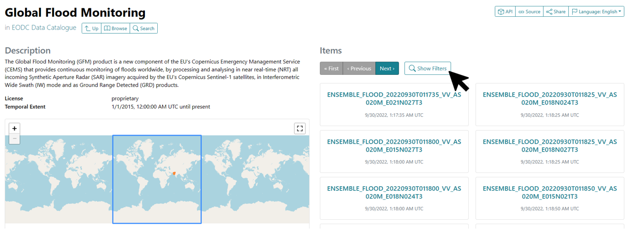
Open https://services.eodc.eu/browser/#/v1/ to explore available collections and filter data by time and spatial extent without writing any code. Use Show Filters to narrow by temporal or spatial extent.
Install QGIS and the STAC plugin
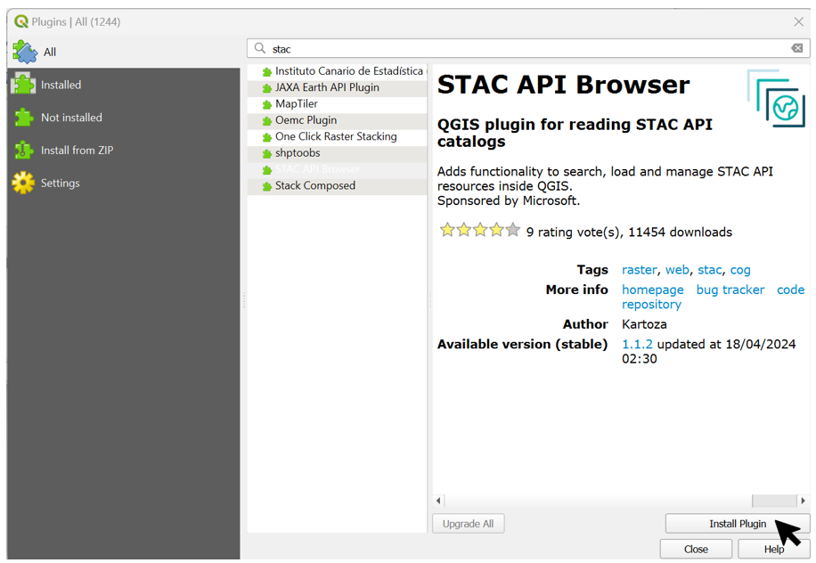
Download QGIS from https://www.qgis.org/en/site/forusers/download.html. After installation, open Plugins → Manage and Install Plugins, search for STAC API Browser, and install it.
Connect to the eodc STAC API
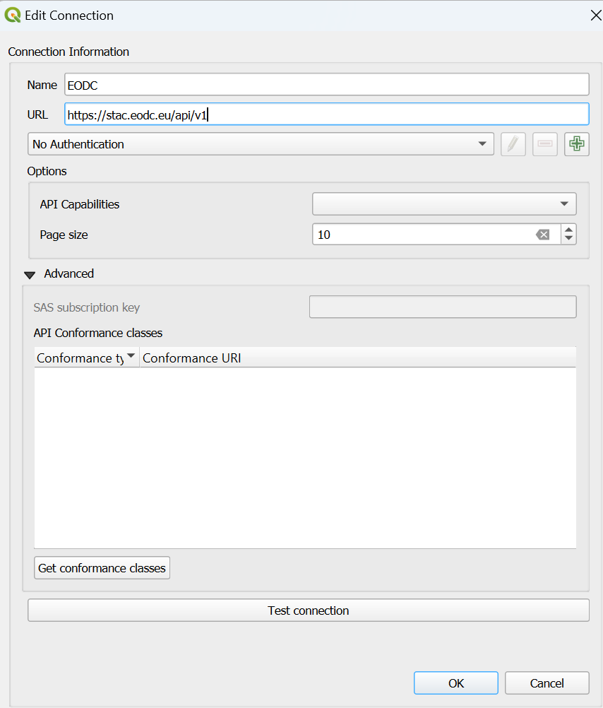
Open Plugins → STAC API Browser Plugin → Open STAC API Browser. Create a new connection (Connections → New) with the URL https://stac.eodc.eu/api/v1, test it, and click OK. Press Fetch collections to load all available datasets.

Filter and load data
Select a collection, enable Filter by date and Extent, then press Search. In the results window, open View assets, check Select to add as a layer for the GeoTIFF asset, and click Add selected assets as layers.
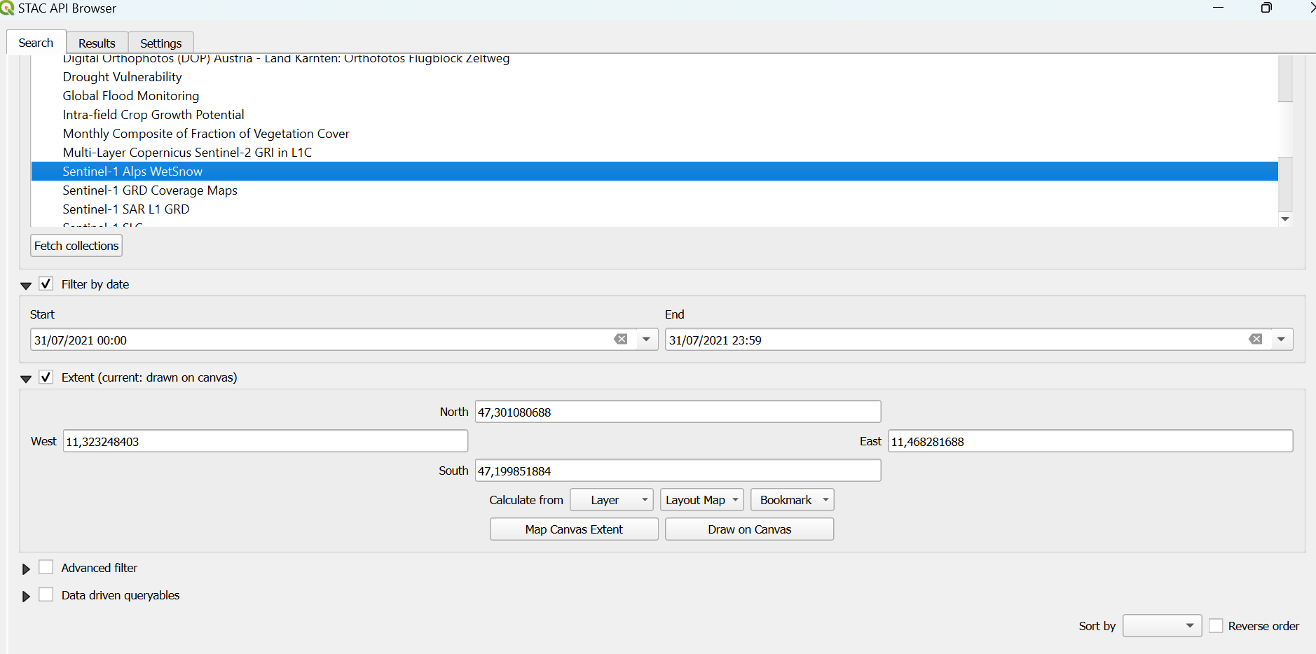
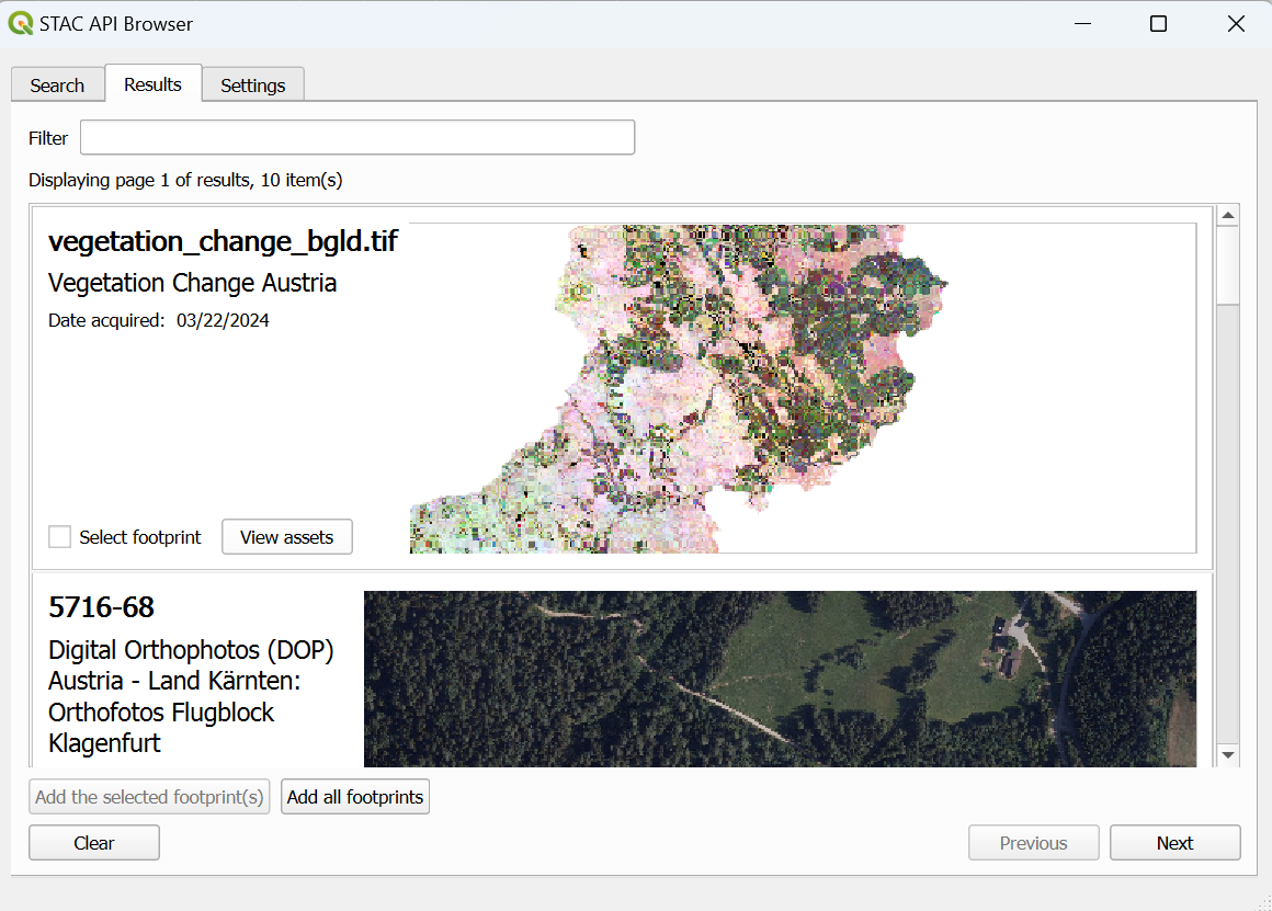
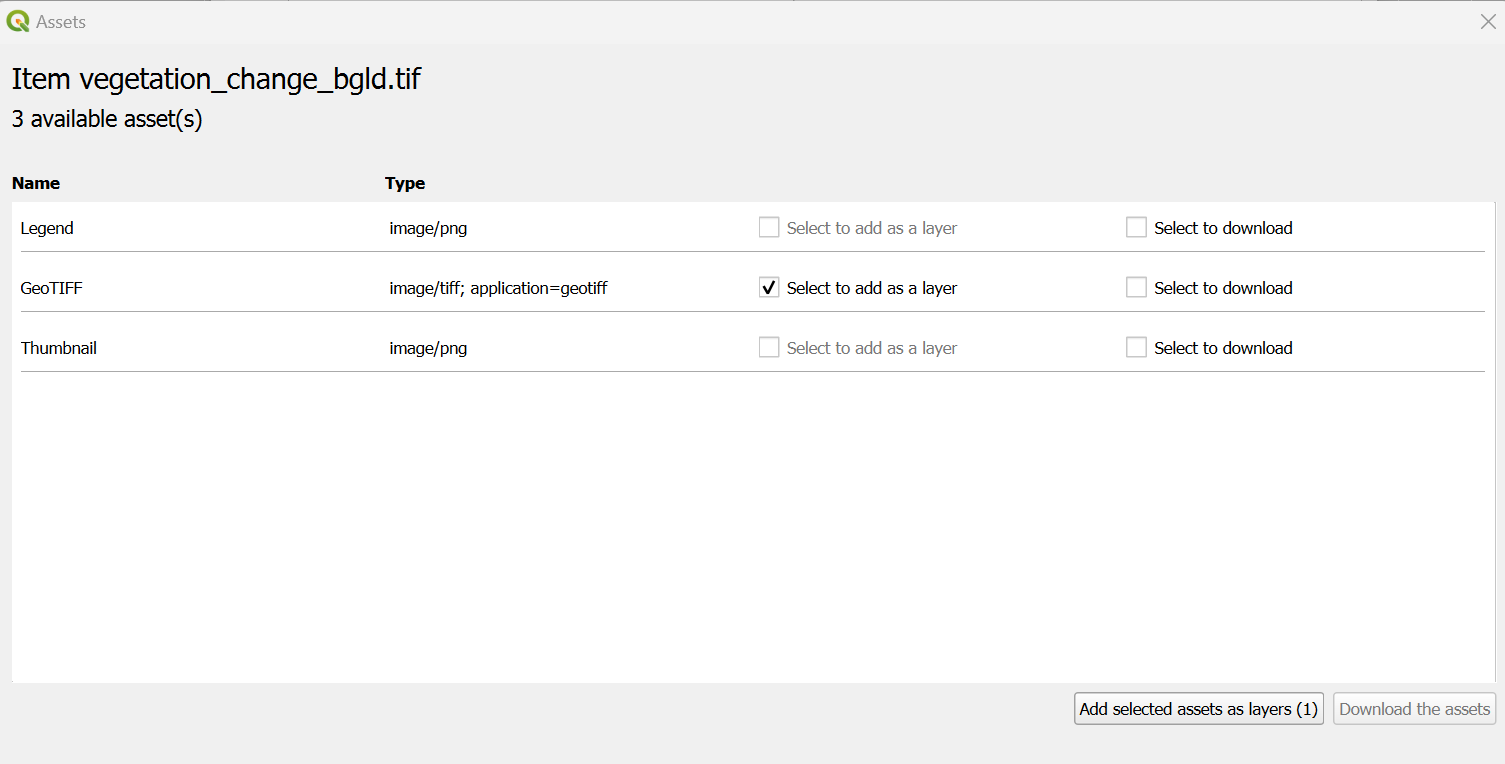
Right-click a loaded layer and choose Zoom to Layer to center the map on it.
Add an orthophoto basemap (Austria)
In the QGIS Browser panel, right-click WMS/WMTS → New Connection. Enter any name and the URL https://mapsneu.wien.gv.at/basemapneu/1.0.0/WMTSCapabilities.xml. The orthophoto layer becomes available after connecting.
Example datasets
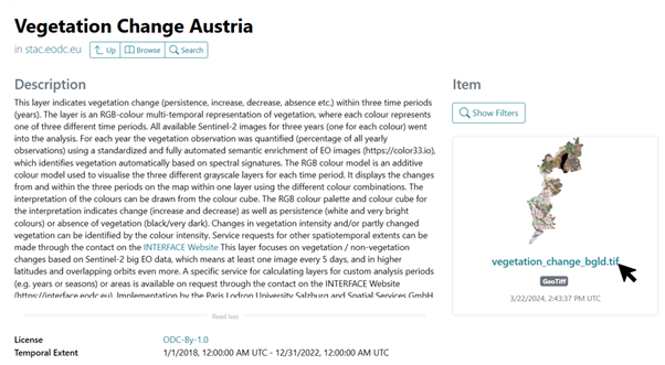
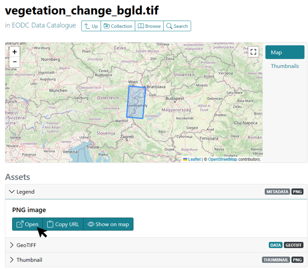
Soil Sealing Identification — Open the Vegetation Change Austria collection in the STAC browser. Download the legend from Assets → Legend → Open and load the vegetation_change_bgld.tif layer. Light areas indicate vegetation detected across all survey years; red areas indicate loss.
Wet Snow — Load the Sentinel-1 Alps WetSnow collection. Pink areas in the rendered layer represent wet (melting) snow.